Your Subtitle text
Maps
 |
 |
 KAWS Webmapper |
||||
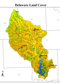
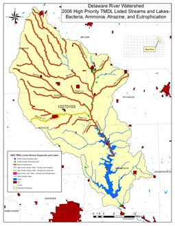
Delaware River Watershed
|
TMDL Streams & Lakes
|
This is a link to a webmapper where users can look at aerial photos and get information on KDHE high priority areas, HUC codes, Public land survey, National wetlands inventory, land cover, topography, and more. |